Arizona Day Trip - Fort Tule
Day Trip: Fort Tule A Challenge, But We'd Do It Again
January 1, 2019

Margie Anderson
Fort Tule: It was an old mining camp apparently. I don't know why it is called a fort on the map.
On my Topo Maps app, this place is shown by a dark square and the name "Fort Tule", designation site. It is north of Lake Pleasant off Cow Creek Road, and from the T-intersection where Castle Hot Springs Road turns sharp left in front of the entrance to the Castle Creek launch ramp at Lake Pleasant, it's a little over 16 miles one way.
It took us about four hours to get there, but that's because we keep stopping to walk around all the time. It took us about 2-1/2 hours to get back to the truck from the site.
Where We Stage
We usually stage at one of the wide areas near the Castle Creek entrance to Pleasant and drive a short way along the road on pavement. There are lots of places along Castle Hot Springs road and Cow Creek Road to stage as well. Some are in the Lake Pleasant Regional Park and you have to pay, but there are plenty of free places too.
From the left at the Pleasant entrance, it's 2.9 miles to the turn-off to Cow Creek Road, and the road is clearly marked. Take Cow Creek Road a little over 2-1/2 miles and you'll see a sign that says "Next Services 47 miles" on the right side of the road. There are two roads to the right - one goes straight up the hill, and one goes around on the right side. You can take either one of them - they join up on the other side of the hill.
Rough Downhill
In about half a mile, you want to take a right turn, and then another shortly after. You can see from the map what I mean. The road then turns more to the south for a while before turning east. As you descend into Humbug Creek, there is a rough downhill slope that is a lot of river rock. The creek wasn't running here when we went, and the flat was full of cockleburrs. We saw a bunch of burros rolling around in the dirt.
About three miles or so from that first right turn in the paragraph above, you'll come to a T. Turn left here to go straight to Fort Tule, or you can go straight and take a big loop around to the east before joining back up to Cow Creek Road.
Into The Tank
Right about in this area we found ourselves in a sort of tunnel formed by the big bushes and trees. It was really pretty and I took tons of pictures. If you take the left turn, pretty soon you'll see a concrete and stone tank on a little hill to the right. You can take a side trip here - it's very short and takes you right up next to the tank. There are pretty views from the top, and it's fun to walk into the tank and look around.
Once you're past that T, just continue on Cow Creek Road a little over four miles until you reach a trail to the right at 33degrees59.824N 112degrees16.837W. Use your Topo Map app. On my app, the Fort Tule site is sort of written almost inside the title of the Governors Peak quadrant title, so it was a bit tough to see at first.
At Least A 4WD
This Jeep trail that you turn onto is less than two miles long, but it took us 35 minutes. It's a rough road and I'm pretty sure you couldn't make it without at least a 4WD. Near the Fort you'll come to a gate with a sign that says "Road Closed Ahead". Keep going and you'll see a gate and fence with a sign that says Tule Creek Riparian Area. This is where the road ends. There's a little go-through on the left of the sign. Park and walk in.
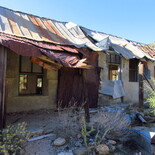
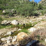
The buildings are in tough shape, but they are still standing - one is a sturdy building with several rooms, a fireplace, and walls that seem to be made by putting concrete over stacked tin cans after the wall reaches window height. The other building is more of a tin shed and it's listing about 45 degrees. If you walk down to the creek, you'll see that there is water in it. Just a little when we were there, and it was stained like strong tea.
In Memory Of 'Pooch'
Under a tree near the main building is a grave. It says "Pooch" at the top, and "A miners faithful friend" across the bottom. So sweet. People have been placing stones on it, so I added a small piece of quartz. There is also an old mine to the right but we didn't go over there. There doesn't seem to be a road to it, and we had our five-month-old puppy, Mochi, with us. She's hasn't quite gotten the message about cactus yet.
A Really Fun Trip
This was a really fun trip - we saw a fox, hawks, burros, coyote, lots of ground squirrels, lizards, and tons of beautiful birds. There is a variety of vegetation, gorgeous views, and challenging bits of road. I wouldn't attempt it without a 4WD - we were in our side by side -- a Can Am Defender. We had a blast and would do it again, even though starting out we weren't sure what to expect.
A Word About Poison Ivy
When we are exploring, we always love to investigate any possible water along the way, so if I see "spring" on the map, we try to find it. On this trip, while looking for a spring, I pushed my way through heavy vegetation to get a picture of a wet spot in the mud. It was a spring all right, just not a gorgeous one. The next day my eyelids and face started to itch and I thought I had gotten bit by mosquitos. But, pretty soon I had tiny blisters and a very red rash on my face, neck, hands, and wrists.

Margie Anderson
Tule Creek Riparian area: This is where the road ends and you just walk through to the left of this sign.
My eyes were swollen and so itchy I thought I'd go nuts. I went to Urgent Care and discovered I had poison ivy - from plants near that spring in the desert! Who knew?
Beware: Leaves Of Three
So a word of warning - keep an eye out for "leaves of three". Poison ivy has three leaves coming from a central stem. The leaves are pointed at each end and may or may not be red. If you do blunder into some, you have about half an hour to get the oil off you. Use soap and water or alcohol. You also need to wash your clothes because if the oil is on those, you can get it from that.
Dogs don't usually get a rash, but if it's on their fur, you can get it from touching them. It's awful and you don't want it. But, if you do somehow get into it, make sure you go to Urgent Care. They gave me steroids that had me feeling much better by the next day.


Reader Comments(0)